
CFD study of how building a solar power plant — requiring partial deforestation — affects soil erosion: wind analysis, sensitive zones and passive solutions.
The essentials. At the request of SOLVEO energie, EOLIOS used CFD simulation to assess the wind-erosion risk linked to building a photovoltaic plant (Bourriot-Bergonce) requiring partial deforestation. A multi-scale analysis — from the territory down to the foot of the panels — maps ground-level wind speeds 10 cm above the soil, before and after the works. Result : deforestation creates localised over-speeds, but the photovoltaic tables act as a passive barrier that slows the flow ; the risk of widespread erosion stays under control, with targeted wind-breaks securing the sensitive zones.
EOLIOS Ingénierie was asked to assess the wind-erosion risks on the Bourriot-Bergonce solar power plant project. Because building the plant required partial deforestation, it was crucial to determine whether reshaping the ground and adding photovoltaic panels could weaken the soils against the wind.
Through an in-depth meteorological analysis coupled with CFD numerical simulations (Computational Fluid Dynamics), our engineers modelled the airflow across the whole site. This made it possible to :
Map the erosion-risk zones at the territory, footprint and panel scales.
Assess the effect of the photovoltaic panels on wind dynamics at ground level.
Size targeted passive solutions to ensure the durability of the installation.
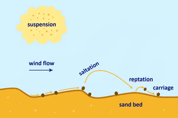
Wind erosion is the displacement of soil particles under the action of the wind. The phenomenon depends on several parameters, such as the nature of the soil, its surface state, the presence or absence of vegetation, and also the intensity and direction of the prevailing winds. When the soil is bare and smooth, the wind can easily mobilise the surface particles, leading to a progressive degradation of the ground.
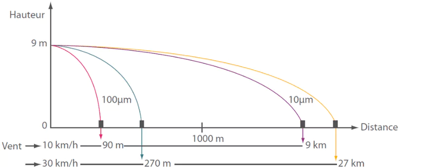
Even a moderate wind can carry dust over kilometres, hence the importance of stopping erosion at the source. In natural environments, vegetation plays a fundamental protective role. It acts both as a screen that slows airflow near the ground and as a factor of mechanical stabilisation thanks to the root systems. Any change to this balance can therefore have a direct impact on the site's sensitivity to erosion.
Wind erosion is the displacement of soil particles under the action of the wind. It depends on the nature and surface state of the soil, on vegetation and on the intensity of the prevailing winds : a bare, smooth soil easily mobilises its surface particles.
Building a photovoltaic plant generally involves reshaping the ground, in particular partial or total deforestation of the area concerned. This change of the site alters the soil roughness and can lead to increased exposure to the prevailing winds. In this context, it is essential to assess whether the new site configuration, once the panels are installed, leads to an increase in erosion risk or whether, on the contrary, the structures help to protect the soils. This is precisely the question the EOLIOS study set out to answer.
The first step of the study is a large-scale analysis of the site and its surroundings. This approach makes it possible to characterise the prevailing wind regimes and to understand how the airflow interacts with the terrain and the surrounding natural features.
This overall picture is essential to identify the most impactful wind directions and to place the project in its territorial context. It forms the foundation on which the finer analyses that follow are built.
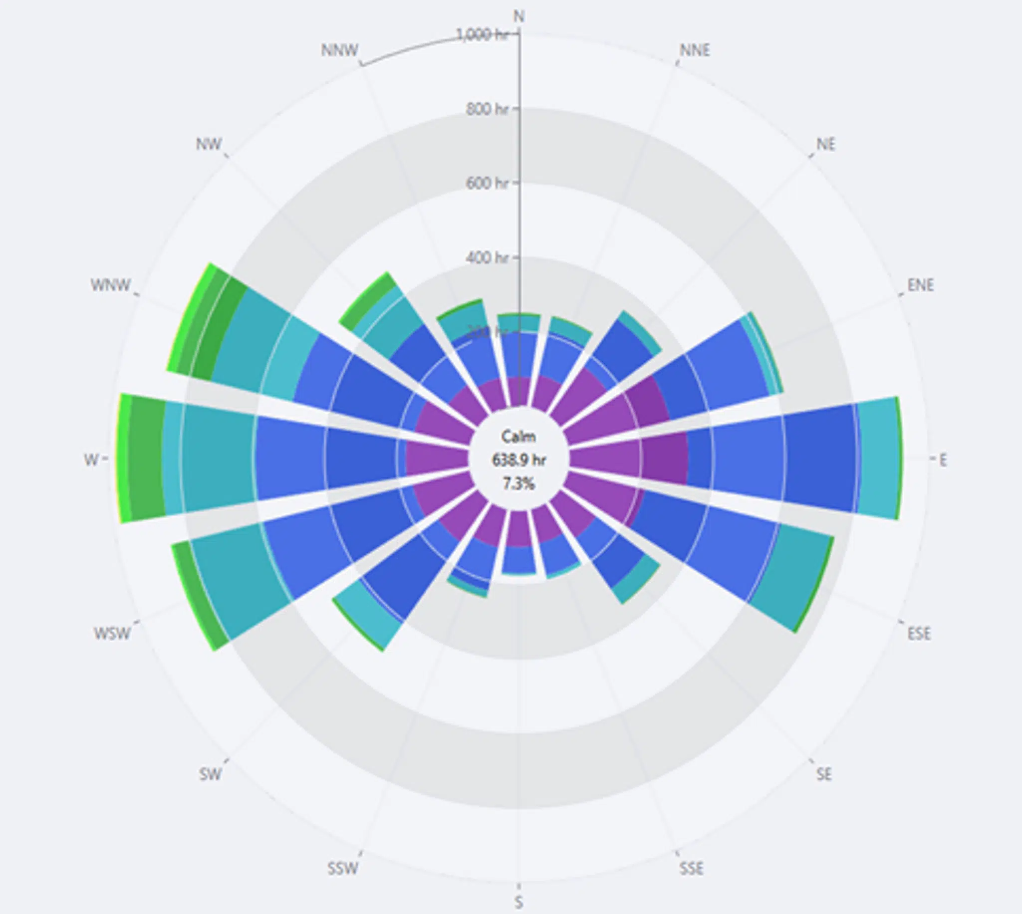
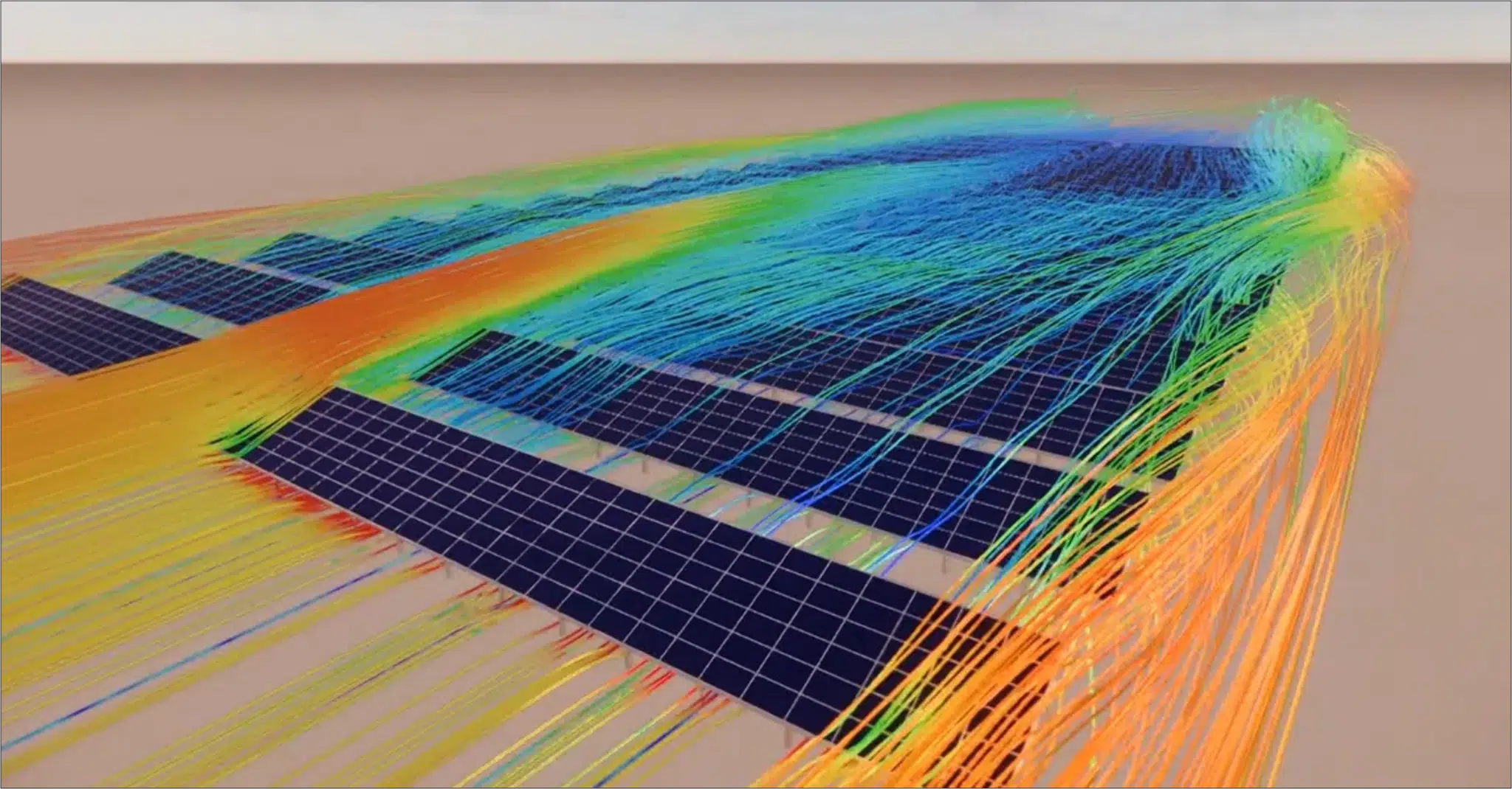
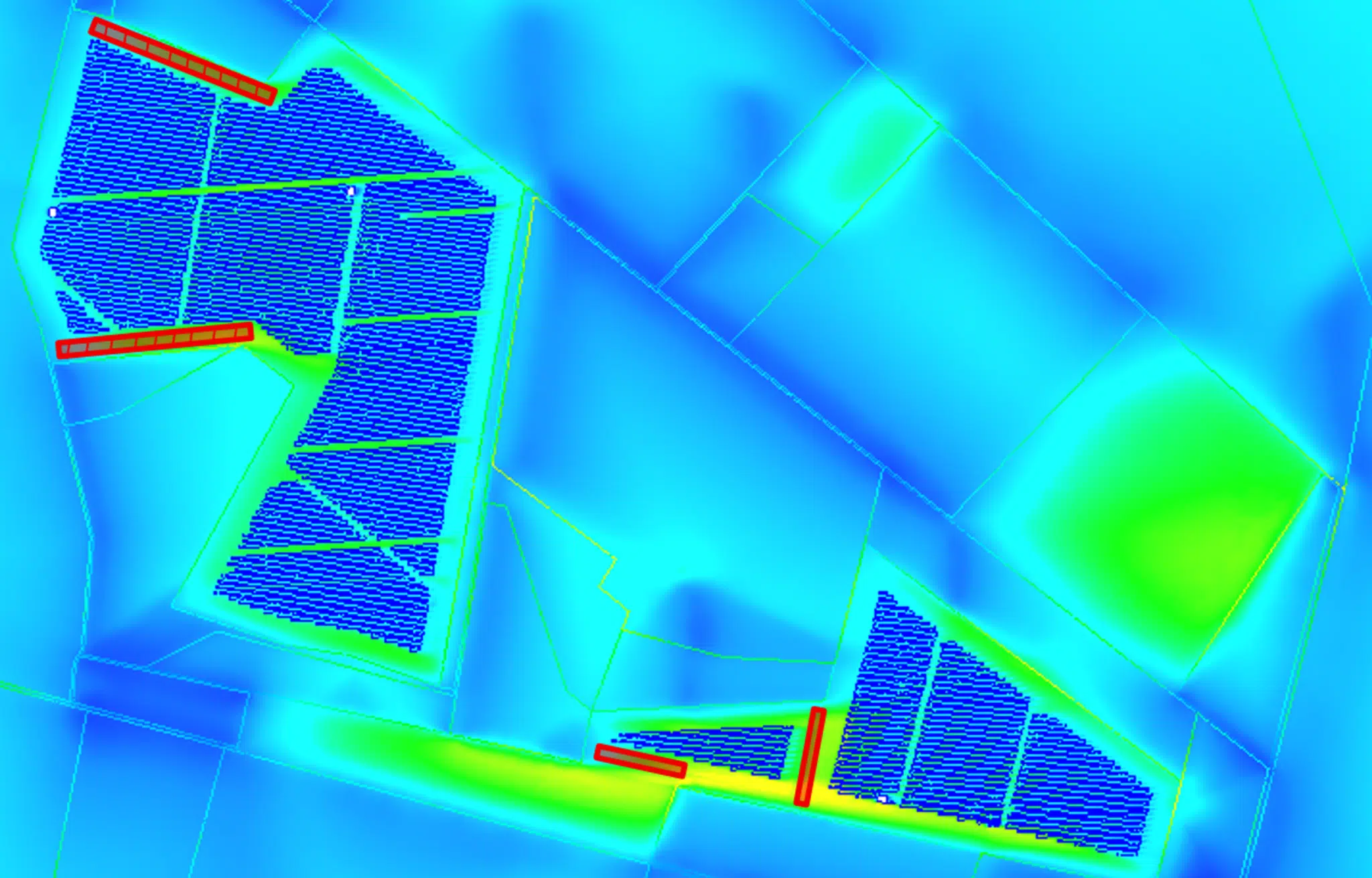
The simulation results reveal over-speed zones, conducive to erosion, that were already present before the project began. The study shows that these phenomena persist after the plant is installed, which underlines the importance of putting in place targeted corrective solutions to lastingly limit the risks of soil degradation. We also note that the wind speed increases at the photovoltaic tables, creating "over-speed streaks" in the immediate vicinity of the structures. These localised accelerations, induced by the altered airflow, make finer studies necessary. By zooming in on these specific zones, our engineers can assess the erosion risks with greater precision where the flows are most dynamic.
An over-speed is a local acceleration of the flow, caused by wind channelling or a geometric discontinuity. At ground level, these « over-speed streaks » concentrate the erosion potential and guide the placement of the wind-breaks.
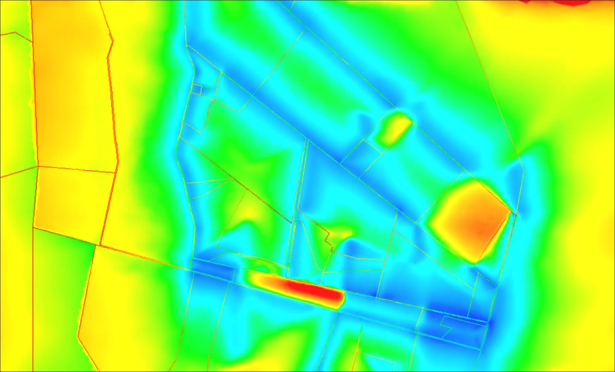
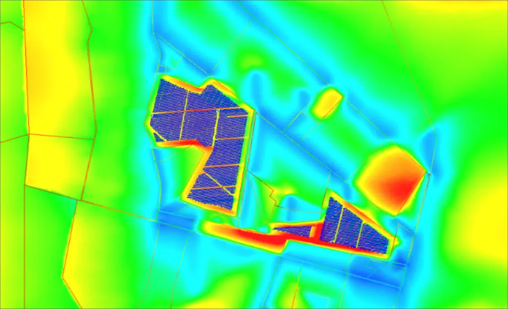
Next, the analysis is tightened to the scale of the project footprint. This step studies the impact of deforestation and of the change of ground surface on the airflow. It highlights the zones where the soil becomes more exposed to the wind and allows the flow behaviour to be compared between the initial state, characterised by vegetation cover, and the state after the works.
Aerodynamic roughness expresses a surface's ability (vegetation, obstacles, structures) to slow the wind near the ground. The higher it is, the more the flow is slowed : deforestation reduces it, while the photovoltaic tables partially reintroduce it.
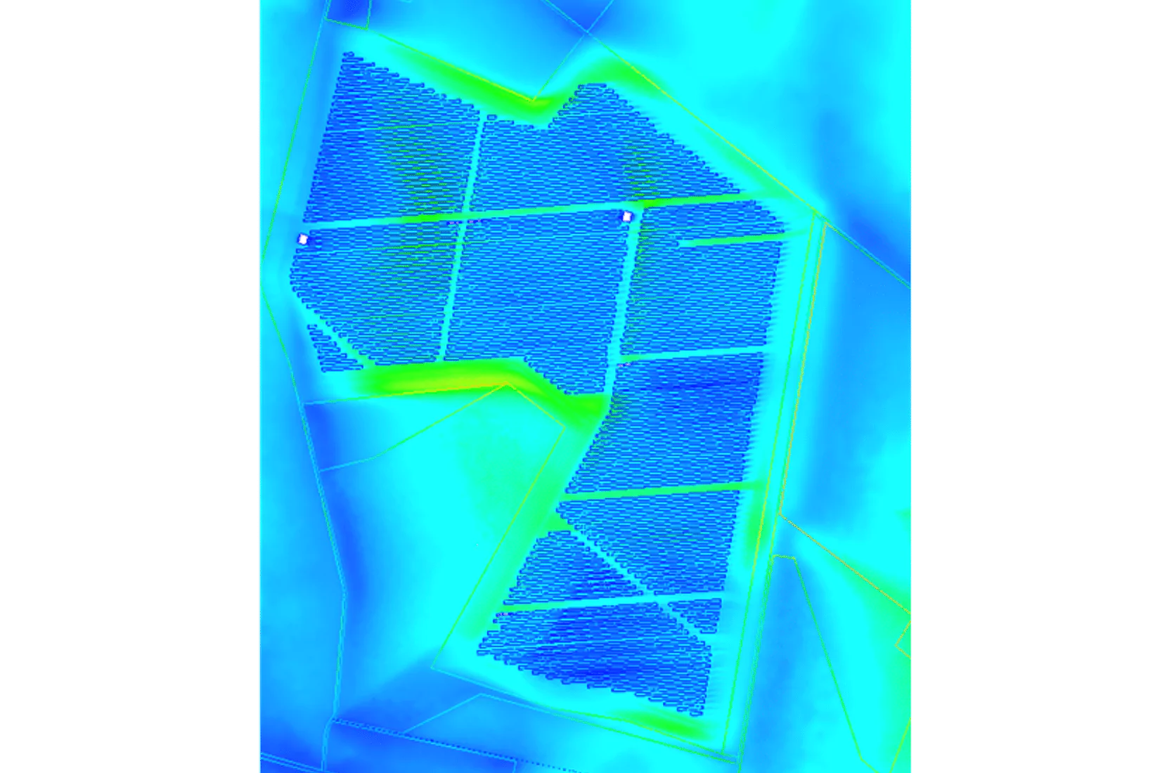
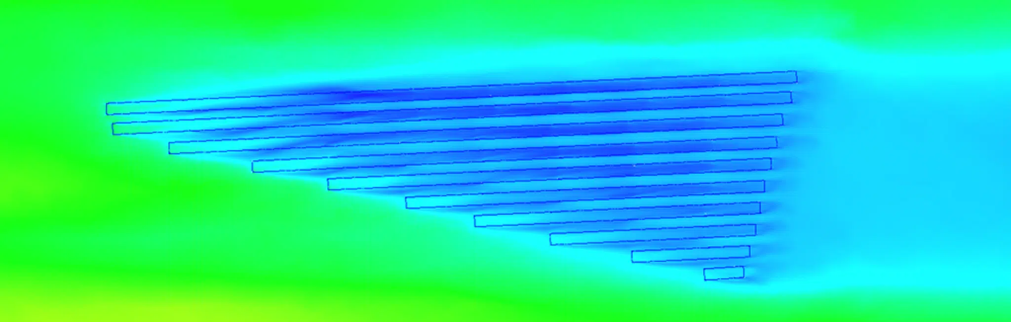
Finally, the study focuses on a local analysis, as close as possible to the photovoltaic panel tables. This fine scale is essential to understand the direct interactions between the wind and the structures. In particular, it makes it possible to assess the effect of the panels on the ground-level wind speeds and to identify any localised acceleration zones, especially in the rows or circulation corridors.
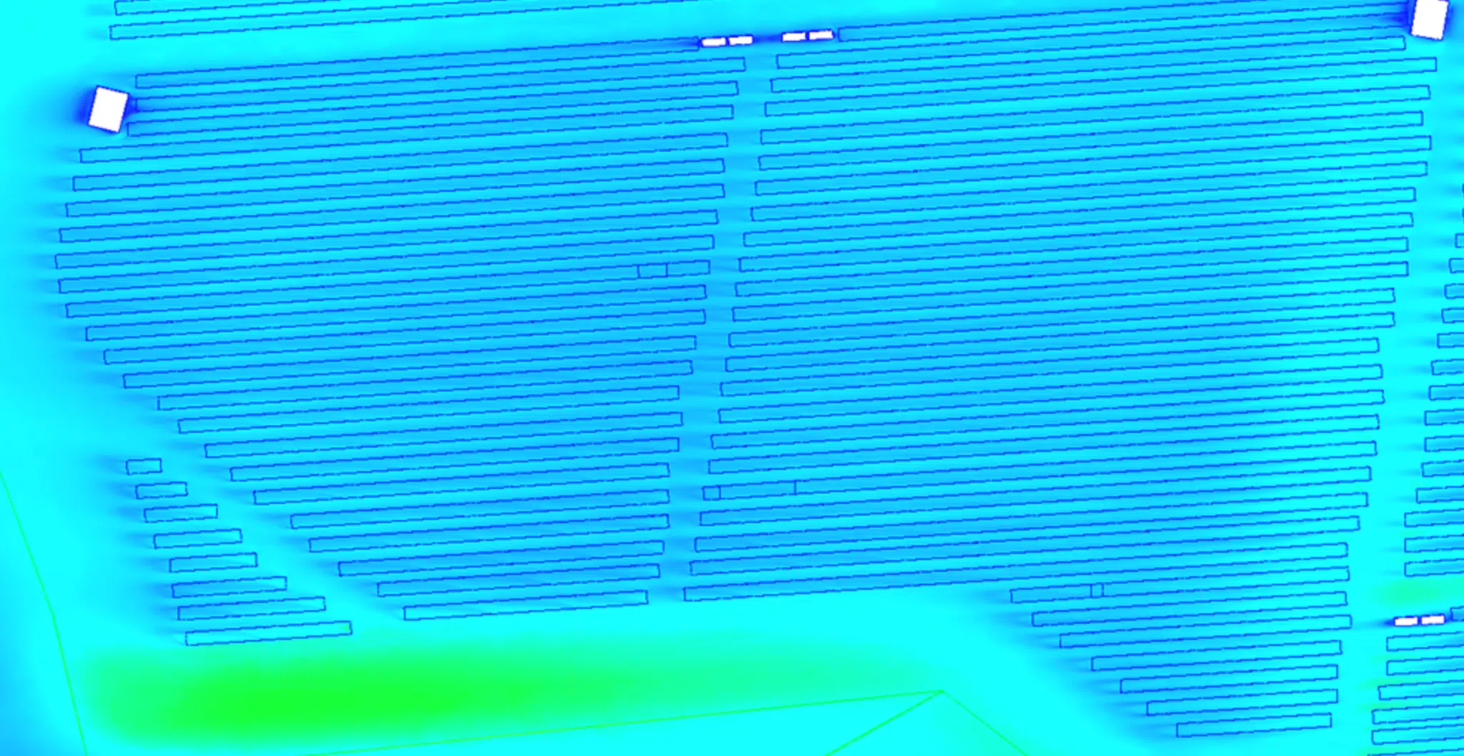
To better understand the impact of the solar panels on the wind flow, a reduced-scale simulation was carried out. This configuration isolates the effect of the photovoltaic structures on the flow dynamics at ground level.
The results reveal a significant damping effect of the photovoltaic tables on the flow :
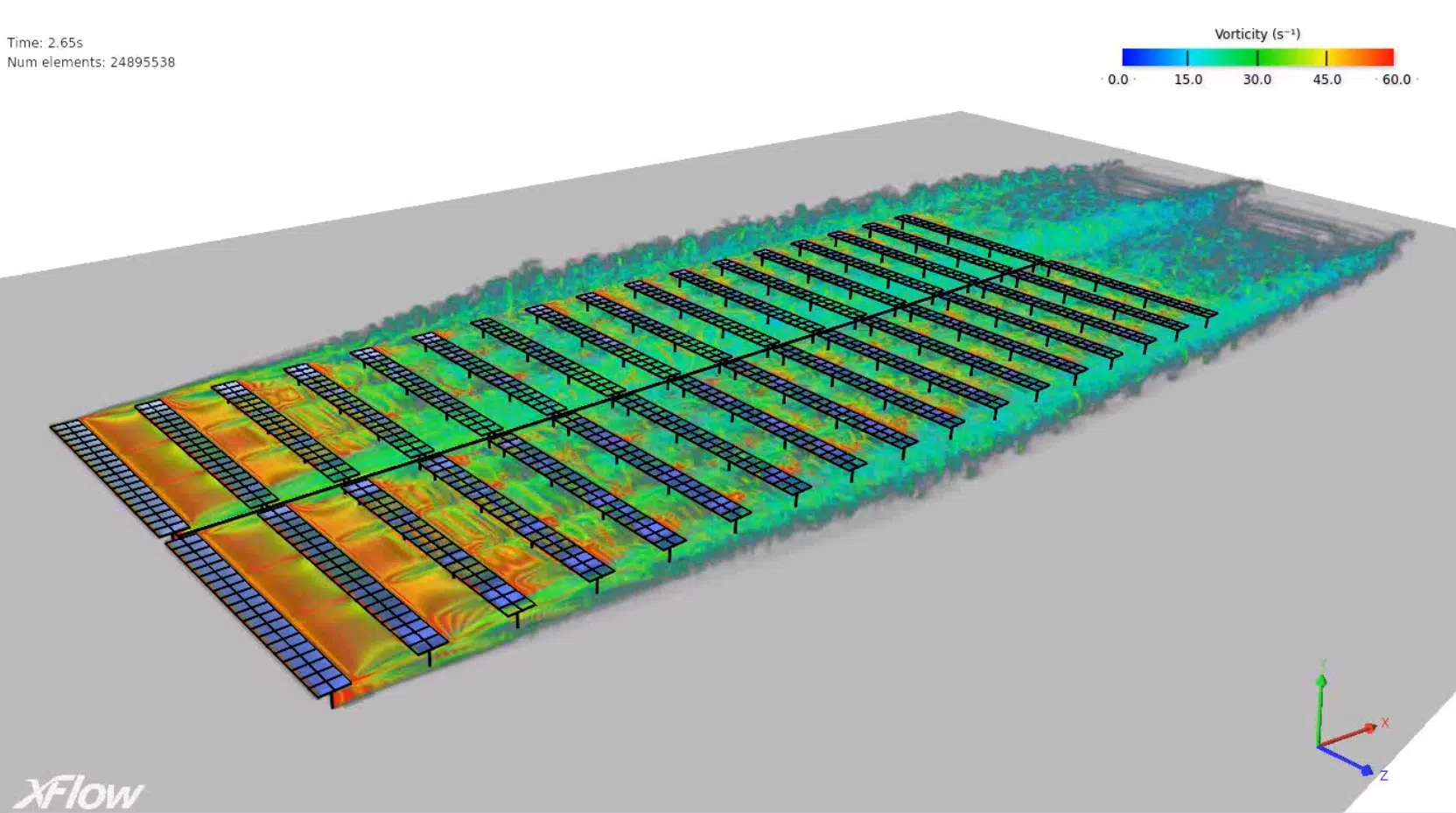
Break-up of the flow and creation of controlled-turbulence zones behind the rows.
Dissipation of kinetic energy, reducing the wind speed in the near-ground layer.
Limitation of the local accelerations in the open spaces between rows.
In practice, this phenomenon helps to reduce the wind-erosion risk on the site.
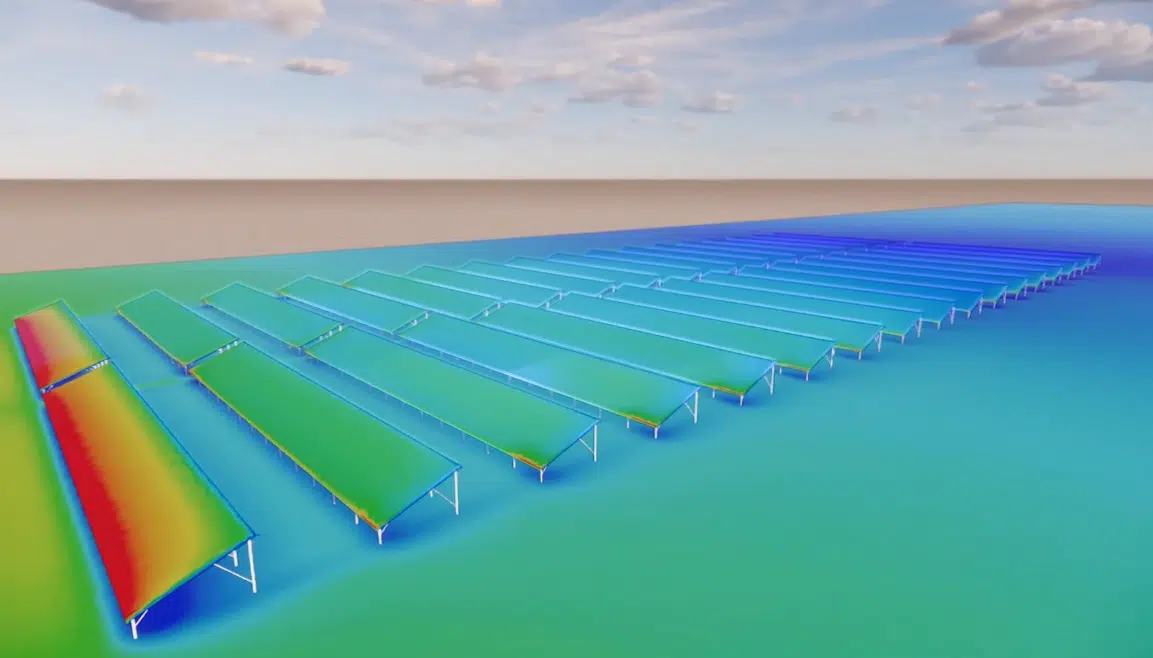
The panels act as a passive barrier, stabilising the airflow and lowering the critical speeds capable of mobilising soil particles. This simulation therefore confirms that the layout and density of the installation play an important role in protecting the soils from the effects of the wind.

The simulation results highlight the impact of deforestation on wind behaviour near the ground. Removing the forest cover causes an increase in wind speeds in the now-open zones, especially when the wind is aligned with the plant's cleared corridors — which happens regularly, since these orientations match the prevailing winds on the site. This change is explained by the loss of the natural obstacles that the trees represented.
In the absence of this vegetation roughness, the wind retains more energy as it approaches the ground, which increases its ability to mobilise the surface particles. Bare soils thus become more sensitive to erosive phenomena, especially in the most exposed areas.
The analysis nevertheless qualifies this finding: the increase in wind speeds does not affect the whole site uniformly. Some zones remain relatively unaffected, depending on their position, the local topography and their distance from the main wind axes.
Beyond this general trend, the results show the appearance of localised wind accelerations in specific zones of the project. These phenomena are mainly linked to the site geometry, to the presence of continuous open areas and to the orientation of certain spaces relative to the prevailing winds.
These accelerations remain isolated and circumscribed, but they are important points of vigilance. In these areas, the wind can reach higher levels than in the rest of the plant, locally increasing the erosion potential. The simulation precisely locates these zones and explains their mechanisms, which is essential to put suitable corrective measures in place.
The protective effect of the panels is not uniform, however, and depends on several parameters, such as their orientation, spacing and alignment relative to the prevailing winds. Some configurations favour the slowing of the flows more, while others can generate local redistributions of the wind. The CFD analysis identifies these differences in behaviour and verifies that, in the configuration chosen for the project, the panel layout overall helps to protect the soils rather than expose them.
Under the wind conditions most commonly encountered on the site, the results indicate that the ground-level wind speeds remain, overall, below the thresholds associated with significant erosion. The risk of widespread erosion thus appears controlled at the scale of the plant. This result highlights the value of a detailed analysis to move past received ideas: when well designed, a photovoltaic plant can limit its impact on soils.
Key takeaway. When well designed, a photovoltaic plant does not necessarily worsen erosion : in the chosen configuration, ground-level speeds stay below the critical thresholds and the tables act as a passive barrier. Vigilance focuses on a few localised acceleration zones, treated with targeted passive devices.
Thanks to CFD, certain more exposed zones could be identified. These areas may experience occasional wind accelerations capable of locally increasing the sensitivity to erosion. Precise mapping of these zones is a valuable tool to guide the corrective actions.
The chosen approach is to intervene only where necessary. For the identified sensitive zones, passive devices such as vegetated wind-breaks or light structures can be installed to break the flow dynamics. These solutions are designed to blend harmoniously into the project environment while ensuring lasting effectiveness.
This study illustrates the ability of EOLIOS Ingénierie to support photovoltaic project developers in addressing environmental issues from the earliest design phases. By anticipating erosion risks, it is possible to secure the project's viability and avoid costly corrective work during operation.
Drawing on numerical simulation, EOLIOS offers a pragmatic approach tailored to the specifics of each site. The aim is to design photovoltaic plants that are high-performing, durable and respectful of their environment, treating aerodynamic constraints as a genuine lever for optimising the project.
Expertise: modeling of sand and dust movementEOLIOS Ingénierie carried out a CFD study to assess the wind-erosion risks associated with building a photovoltaic plant requiring partial deforestation. Through a multi-scale approach, numerical simulations mapped the airflow across the whole site, before and after the works. The results show that deforestation causes a localised increase in wind speeds, generating isolated over-speed zones that are potentially erosive. However, the photovoltaic panels play a significant protective role by introducing an artificial roughness that slows the flows at ground level. Under common wind conditions, the ground-level speeds remain, overall, below the critical erosion thresholds, keeping the widespread risk under control. Targeted passive devices, such as vegetated wind-breaks, are recommended in the most exposed areas to ensure the durability of the site.
Wind erosion, solar power plants and CFD simulation of soil protection.
Wind erosion is the displacement of soil particles under the effect of the wind. It depends on the nature and surface state of the soil, the presence of vegetation, and the intensity and direction of the prevailing winds. On a bare, smooth soil, even a moderate wind can mobilise particles and carry dust over kilometres.
It increases it locally : by removing the vegetation roughness, the wind retains more energy near the ground, especially when the cleared corridors are aligned with the prevailing winds. The effect is not uniform, however — some zones stay little affected depending on topography and distance from the main wind axes.
In the configuration studied, they overall protect the soils : the tables act as a passive barrier that breaks up the flow, creates controlled turbulence behind the rows and reduces the speed near the ground. The effect nonetheless depends on their orientation, spacing and alignment relative to the prevailing winds.
CFD simulation maps ground-level wind speeds at several scales (territory, footprint, foot of the panels), before and after the works. It precisely locates the over-speed zones and makes it possible to size targeted corrective solutions rather than treating the whole site. See also our expertise modeling of sand and dust movement.
Passive devices — vegetated wind-breaks or light structures — are installed only where CFD reveals local accelerations. They break the flow dynamics, blend into the project environment and ensure lasting effectiveness without a site-wide overcost.
Explore our expertise, projects and technical papers to go further than the FAQ.
 SolarWind impact — solar power plant
 Extreme windsExtreme winds — solar power plant
 RooftopRooftop d'un palace — Casablanca
 Pedestrian comfortPedestrian comfort — La Défense
 Pedestrian comfortWind comfort — balconies
 High-riseWind impacts — Tours Olympiades — Paris
 High-riseWind impact — High-rise tower — Caen